 vesseltracker.com
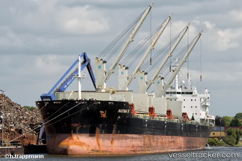
 MARINA R
Current Status
Where is the vessel?
MARINA R is currently in 162 nm W of Saint-Gilles, based on AIS data received about 1h ago.
Latest AIS update:
Current position: 21.23183° S, 52.34417° E (162 nm W of Saint-Gilles)
Average speed (last 7 days): Loading…
Average speed (last 30 days): Loading…
Vessel profile: MARINA R is a Bulk Carrier with dimensions m x m.
This page combines live AIS, route history, probable destination signals, nearby traffic, and port activity for practical vessel monitoring.
The current position of vessel MARINA R is -21.23183 lat / 52.34417 lng. Updated: 2026-05-14 21:26:38 UTCNearest reference points:
- 194 nm E of Manakara
- 209 nm E of Manakara
Currently sailing under the flag of Marshall Islands ![]()
Details:
Live Vessel MARINA R Analytics (details, animations, etc.)
Recent AIS points (UTC):
2026-05-14 17:54:57 UTC · -20.80136, 52.89218 · SOG 11.4 kn · COG 227°2026-05-14 19:25:09 UTC · -20.97667, 52.65333 · SOG 11 kn · COG -1°
2026-05-14 20:01:10 UTC · -21.05167, 52.56167 · SOG 11 kn · COG -1°
2026-05-14 21:26:38 UTC · -21.23183, 52.34417 · SOG 11.6 kn · COG 228°