 vesseltracker.com
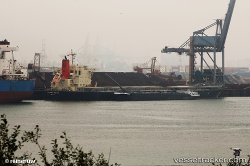
 CHRISEA
Current Status
Where is the vessel?
CHRISEA is currently in 122 nm SE of Quequen, based on AIS data received about 1h ago.
Latest AIS update:
Current position: 40.14953° S, 57.02223° W (122 nm SE of Quequen)
Average speed (last 7 days): Loading…
Average speed (last 30 days): Loading…
Vessel profile: CHRISEA is a Bulk Carrier with dimensions m x m.
This page combines live AIS, route history, probable destination signals, nearby traffic, and port activity for practical vessel monitoring.
The current position of vessel CHRISEA is -40.14953 lat / -57.02223 lng. Updated: 2026-05-15 07:53:05 UTCNearest reference points:
- 186 nm S of Quequen
- Near Mar Del Plata
- Near NECOCHEA
Currently sailing under the flag of Marshall Islands ![]()
Details:
Live Vessel CHRISEA Analytics (details, animations, etc.)
Recent AIS points (UTC):
2026-05-15 04:20:54 UTC · -40.80600, -57.30529 · SOG 11.9 kn · COG 18°2026-05-15 05:39:21 UTC · -40.56197, -57.20314 · SOG 11.3 kn · COG 18°
2026-05-15 07:36:44 UTC · -40.19993, -57.04657 · SOG 12.1 kn · COG 18°
2026-05-15 07:53:05 UTC · -40.14953, -57.02223 · SOG 11.7 kn · COG 19°