 vesseltracker.com
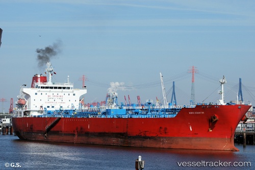
 SC EQUATOR
Current Status
Where is the vessel?
SC EQUATOR is currently in 22 nm SE of Sabine Pass, based on AIS data received less than 1h ago.
Latest AIS update:
Current position: 29.43485° N, 93.64262° W (22 nm SE of Sabine Pass)
Average speed (last 7 days): Loading…
Average speed (last 30 days): Loading…
Vessel profile: SC EQUATOR is a Oil/Chemical Tanker with dimensions m x m.
This page combines live AIS, route history, probable destination signals, nearby traffic, and port activity for practical vessel monitoring.
The current position of vessel SC EQUATOR is 29.43485 lat / -93.64262 lng. Updated: 2026-05-16 16:04:29 UTCNearest reference points:
- 23 nm SW of Sabine Pass
- Near SABINE PASS
- 10 nm W of Sabine Pass
Currently sailing under the flag of Marshall Islands ![]()
Details:
Live Vessel SC EQUATOR Analytics (details, animations, etc.)
Recent AIS points (UTC):
2026-05-16 11:22:28 UTC · 29.43470, -93.64079 · SOG 0 kn · COG 214°2026-05-16 13:43:30 UTC · 29.43492, -93.64148 · SOG 0 kn · COG 195°
2026-05-16 14:13:31 UTC · 29.43494, -93.64160 · SOG 0 kn · COG 192°
2026-05-16 16:04:29 UTC · 29.43485, -93.64262 · SOG 0 kn · COG 166°