 vesseltracker.com
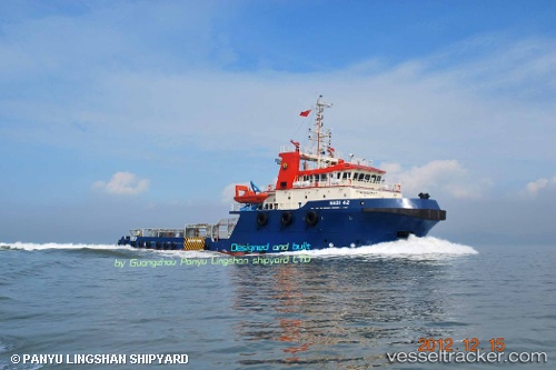
 MARSOL SUPREME
Current Status
Where is the vessel?
MARSOL SUPREME is currently in Near Esnnad, based on AIS data received about 1h ago.
Latest AIS update:
Current position: 24.31344° N, 54.48090° E (Near Esnnad)
Average speed (last 7 days): Loading…
Average speed (last 30 days): Loading…
Vessel profile: MARSOL SUPREME is a Anchor Handling Vessel with dimensions m x m.
This page combines live AIS, route history, probable destination signals, nearby traffic, and port activity for practical vessel monitoring.
The current position of vessel MARSOL SUPREME is 24.31344 lat / 54.48090 lng. Updated: 2026-04-25 20:02:53 UTCNearest reference points:
- Near Esnnad
- Near KHALIFA
- Near Jebel Ali Free Zone
Currently sailing under the flag of Marshall Islands ![]()
Details:
Live Vessel MARSOL SUPREME Analytics (details, animations, etc.)
Recent AIS points (UTC):
2026-04-25 16:50:52 UTC · 24.31344, 54.48089 · SOG 0 kn · COG 180°2026-04-25 18:11:52 UTC · 24.31344, 54.48092 · SOG 0 kn · COG 180°
2026-04-25 19:38:53 UTC · 24.31342, 54.48089 · SOG 0.1 kn · COG 181°
2026-04-25 20:02:53 UTC · 24.31344, 54.48090 · SOG 0 kn · COG 181°