 vesseltracker.com
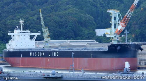
 IOANNA FORCE
Current Status
Where is the vessel?
IOANNA FORCE is currently in 242 nm E of Levelwood, based on AIS data received about 1h ago.
Latest AIS update:
Current position: 14.57340° S, 1.54593° W (242 nm E of Levelwood)
Average speed (last 7 days): Loading…
Average speed (last 30 days): Loading…
Vessel profile: IOANNA FORCE is a Cargo with dimensions m x m.
This page combines live AIS, route history, probable destination signals, nearby traffic, and port activity for practical vessel monitoring.
The current position of vessel IOANNA FORCE is -14.57340 lat / -1.54593 lng. Updated: 2026-05-15 10:04:18 UTCNearest reference points:
- 356 nm E of Rupert's Bay
- 357 nm E of Rupert's Bay
- Open sea, approx. 401 nm off the nearest listed port
Currently sailing under the flag of Marshall Islands ![]()
Details:
Live Vessel IOANNA FORCE Analytics (details, animations, etc.)
Recent AIS points (UTC):
2026-05-15 07:31:49 UTC · -14.24205, -1.81573 · SOG 10.2 kn · COG 142°2026-05-15 08:12:19 UTC · -14.33187, -1.74319 · SOG 10 kn · COG 140°
2026-05-15 09:24:00 UTC · -14.48572, -1.61678 · SOG 9.9 kn · COG 142°
2026-05-15 10:04:18 UTC · -14.57340, -1.54593 · SOG 9.9 kn · COG 141°