 vesseltracker.com
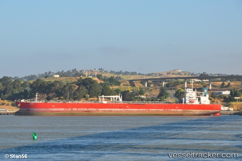
 ALQADISIA
Current Status
Where is the vessel?
ALQADISIA is currently in Near SAKAI, based on AIS data received less than 1h ago.
Latest AIS update:
Current position: 34.56105° N, 135.40503° E (Near SAKAI)
Average speed (last 7 days): Loading…
Average speed (last 30 days): Loading…
Vessel profile: ALQADISIA is a Crude Oil Tanker with dimensions m x m.
This page combines live AIS, route history, probable destination signals, nearby traffic, and port activity for practical vessel monitoring.
The current position of vessel ALQADISIA is 34.56105 lat / 135.40503 lng. Updated: 2026-04-24 07:22:06 UTCNearest reference points:
- Near SAKAI
- Near Nada-Ku, Hyogo
- Near Kobe
Currently sailing under the flag of Marshall Islands ![]()
Details:
Live Vessel ALQADISIA Analytics (details, animations, etc.)
Recent AIS points (UTC):
2026-04-24 03:42:30 UTC · 34.54907, 135.28163 · SOG 9.2 kn · COG 49°2026-04-24 04:36:12 UTC · 34.55783, 135.39920 · SOG 2.8 kn · COG 63°
2026-04-24 05:43:04 UTC · 34.56105, 135.40504 · SOG 0 kn · COG 65°
2026-04-24 07:22:06 UTC · 34.56105, 135.40503 · SOG 0 kn · COG 65°