 vesseltracker.com
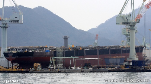
 ARAUCARIA
Current Status
Where is the vessel?
ARAUCARIA is currently in Near Koumac, based on AIS data received less than 1h ago.
Latest AIS update:
Current position: 20.49540° S, 164.17010° E (Near Koumac)
Average speed (last 7 days): Loading…
Average speed (last 30 days): Loading…
Vessel profile: ARAUCARIA is a Cargo with dimensions m x m.
This page combines live AIS, route history, probable destination signals, nearby traffic, and port activity for practical vessel monitoring.
The current position of vessel ARAUCARIA is -20.49540 lat / 164.17010 lng. Updated: 2026-04-24 19:49:28 UTCNearest reference points:
- Near Noumea
Currently sailing under the flag of Marshall Islands ![]()
Details:
Live Vessel ARAUCARIA Analytics (details, animations, etc.)
Recent AIS points (UTC):
2026-04-24 15:46:35 UTC · -20.49536, 164.17017 · SOG 0 kn · COG 163°2026-04-24 16:01:28 UTC · -20.49537, 164.17017 · SOG 0 kn · COG 163°
2026-04-24 17:35:09 UTC · -20.49588, 164.17027 · SOG 0 kn · COG 163°
2026-04-24 19:49:28 UTC · -20.49540, 164.17010 · SOG 0 kn · COG 163°