 vesseltracker.com
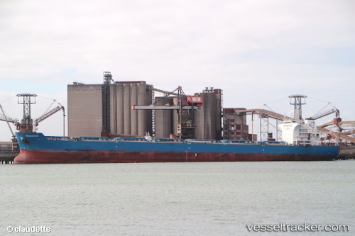
 SEA GLORY
Current Status
Where is the vessel?
SEA GLORY is currently in 55 nm NE of BITUNG, based on AIS data received about 2h ago.
Latest AIS update:
Current position: 2.20378° N, 125.65964° E (55 nm NE of BITUNG)
Average speed (last 7 days): Loading…
Average speed (last 30 days): Loading…
Vessel profile: SEA GLORY is a Bulk Carrier with dimensions m x m.
This page combines live AIS, route history, probable destination signals, nearby traffic, and port activity for practical vessel monitoring.
The current position of vessel SEA GLORY is 2.20378 lat / 125.65964 lng. Updated: 2026-04-28 04:42:53 UTCNearest reference points:
- Near BITUNG
- Near TERNATE
- 13 nm NE of WEDA
Currently sailing under the flag of Marshall Islands ![]()
Details:
Live Vessel SEA GLORY Analytics (details, animations, etc.)
Recent AIS points (UTC):
2026-04-27 23:04:12 UTC · 3.13874, 125.85339 · SOG 10.1 kn · COG 194°2026-04-27 23:04:12 UTC · 3.13874, 125.85339 · SOG 10.1 kn · COG 194°
2026-04-27 23:04:12 UTC · 3.13874, 125.85339 · SOG 10.1 kn · COG 194°
2026-04-28 04:42:53 UTC · 2.20378, 125.65964 · SOG 10.1 kn · COG 193°