 vesseltracker.com
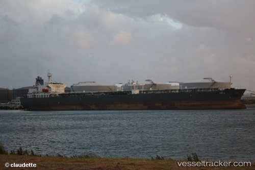
 LV ESTIA
Current Status
Where is the vessel?
LV ESTIA is currently in 34 nm W of Kuala Selangor, based on AIS data received less than 1h ago.
Latest AIS update:
Current position: 3.41667° N, 100.49333° E (34 nm W of Kuala Selangor)
Average speed (last 7 days): Loading…
Average speed (last 30 days): Loading…
Vessel profile: LV ESTIA is a Crude Oil Tanker with dimensions m x m.
This page combines live AIS, route history, probable destination signals, nearby traffic, and port activity for practical vessel monitoring.
The current position of vessel LV ESTIA is 3.41667 lat / 100.49333 lng. Updated: 2026-04-27 16:11:39 UTCNearest reference points:
- 11 nm W of Pangkur
- Near PANGKOR
- Near Westport/Port Klang
Currently sailing under the flag of Marshall Islands ![]()
Details:
Live Vessel LV ESTIA Analytics (details, animations, etc.)
Recent AIS points (UTC):
2026-04-27 12:21:46 UTC · 3.35468, 100.54098 · SOG 9.9 kn · COG 330°2026-04-27 13:29:40 UTC · 3.43500, 100.49333 · SOG 1 kn · COG -1°
2026-04-27 15:29:38 UTC · 3.45333, 100.48167 · SOG 1 kn · COG -1°
2026-04-27 16:11:39 UTC · 3.41667, 100.49333 · SOG 9 kn · COG -1°