 vesseltracker.com
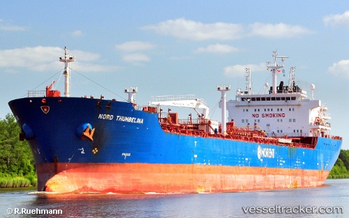
 CHARA
CHARA
Current Status
Where is the vessel?
CHARA is currently in 52 nm N of Boboras, based on AIS data received about 4h ago.
Latest AIS update:
Current position: 47.27123° N, 7.77580° W (52 nm N of Boboras)
Average speed (last 7 days): Loading…
Average speed (last 30 days): Loading…
Vessel profile: CHARA is a Oil Products Tanker with dimensions m x m.
This page combines live AIS, route history, probable destination signals, nearby traffic, and port activity for practical vessel monitoring.
The current position of vessel CHARA is 47.27123 lat / -7.77580 lng. Updated: 2026-05-16 09:21:40 UTCNearest reference points:
- 58 nm SE of Rietheim-Weilheim
- 60 nm SE of San Clodio
- 57 nm S of Boboras
Currently sailing under the flag of Marshall Islands ![]()
Details:
Live Vessel CHARA Analytics (details, animations, etc.)
Recent AIS points (UTC):
2026-05-16 09:21:40 UTC · 47.27123, -7.77580 · SOG 12.6 kn · COG 223°2026-05-16 09:21:40 UTC · 47.27123, -7.77580 · SOG 12.6 kn · COG 223°
2026-05-16 09:21:40 UTC · 47.27123, -7.77580 · SOG 12.6 kn · COG 223°
2026-05-16 09:21:40 UTC · 47.27123, -7.77580 · SOG 12.6 kn · COG 223°