 vesseltracker.com
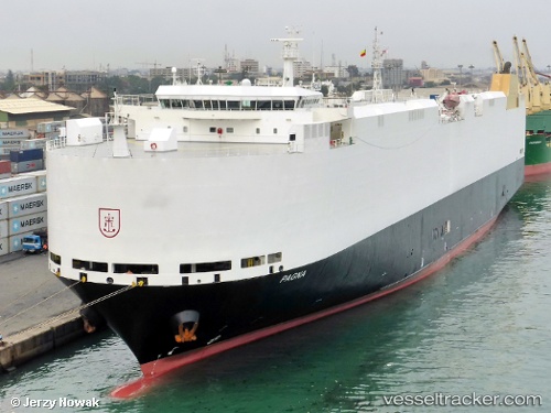
 PAGNA
PAGNA
Current Status
Where is the vessel?
PAGNA is currently in 15 nm NE of Mauk, based on AIS data received about 1h ago.
Latest AIS update:
Current position: 5.83161° S, 106.61572° E (15 nm NE of Mauk)
Average speed (last 7 days): Loading…
Average speed (last 30 days): Loading…
Vessel profile: PAGNA is a Vehicles Carrier with dimensions m x m.
This page combines live AIS, route history, probable destination signals, nearby traffic, and port activity for practical vessel monitoring.
The current position of vessel PAGNA is -5.83161 lat / 106.61572 lng. Updated: 2026-05-14 01:37:32 UTCNearest reference points:
- 19 nm N of Cilincing
- Near New Priok Port
- Near Manggadua
Currently sailing under the flag of Marshall Islands ![]()
Details:
Live Vessel PAGNA Analytics (details, animations, etc.)
Recent AIS points (UTC):
2026-05-13 22:15:50 UTC · -5.95405, 105.78117 · SOG 15.7 kn · COG 34°2026-05-13 23:45:26 UTC · -5.78108, 106.11881 · SOG 16.1 kn · COG 87°
2026-05-14 01:07:32 UTC · -5.83195, 106.48110 · SOG 16.1 kn · COG 112°
2026-05-14 01:37:32 UTC · -5.83161, 106.61572 · SOG 16.3 kn · COG 79°