 vesseltracker.com
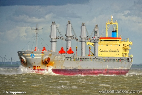
 LUCKY FINDER
Current Status
Where is the vessel?
LUCKY FINDER is currently in Near Aarhus, based on AIS data received less than 1h ago.
Latest AIS update:
Current position: 56.14578° N, 10.22286° E (Near Aarhus)
Average speed (last 7 days): Loading…
Average speed (last 30 days): Loading…
Vessel profile: LUCKY FINDER is a Bulk Carrier with dimensions m x m.
This page combines live AIS, route history, probable destination signals, nearby traffic, and port activity for practical vessel monitoring.
The current position of vessel LUCKY FINDER is 56.14578 lat / 10.22286 lng. Updated: 2026-05-02 18:16:56 UTCNearest reference points:
- Near Randers
- Near Horsens
- Near Glesborg
Currently sailing under the flag of Marshall Islands ![]()
Details:
Live Vessel LUCKY FINDER Analytics (details, animations, etc.)
Recent AIS points (UTC):
2026-05-02 13:34:56 UTC · 56.14578, 10.22283 · SOG 0 kn · COG 215°2026-05-02 16:04:56 UTC · 56.14576, 10.22282 · SOG 0 kn · COG 215°
2026-05-02 16:28:56 UTC · 56.14579, 10.22286 · SOG 0 kn · COG 215°
2026-05-02 18:16:56 UTC · 56.14578, 10.22286 · SOG 0 kn · COG 215°