 vesseltracker.com
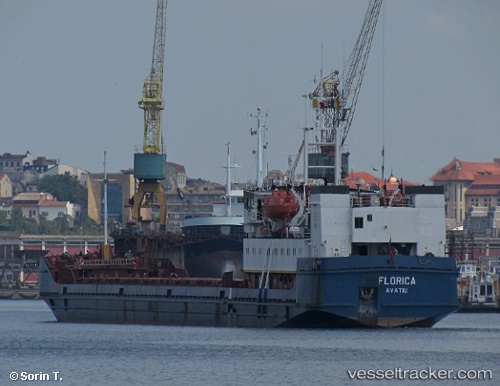
 FLORICA
Current Status
Where is the vessel?
FLORICA is currently in 15 nm SW of Bozcaada, based on AIS data received less than 1h ago.
Latest AIS update:
Current position: 39.66757° N, 25.83296° E (15 nm SW of Bozcaada)
Average speed (last 7 days): Loading…
Average speed (last 30 days): Loading…
Vessel profile: FLORICA is a General Cargo with dimensions m x m.
This page combines live AIS, route history, probable destination signals, nearby traffic, and port activity for practical vessel monitoring.
The current position of vessel FLORICA is 39.66757 lat / 25.83296 lng. Updated: 2026-05-17 19:33:35 UTCNearest reference points:
- 14 nm SW of Bozcaada
- 14 nm NW of Baba Point
- Near Baba Point
Currently sailing under the flag of Nauru ![]()
Details:
Live Vessel FLORICA Analytics (details, animations, etc.)
Recent AIS points (UTC):
2026-05-17 15:56:24 UTC · 40.00106, 25.97290 · SOG 6.8 kn · COG 216°2026-05-17 15:56:24 UTC · 40.00106, 25.97290 · SOG 6.8 kn · COG 216°
2026-05-17 19:10:07 UTC · 39.70613, 25.83995 · SOG 6 kn · COG 193°
2026-05-17 19:33:35 UTC · 39.66757, 25.83296 · SOG 5.8 kn · COG 193°