 vesseltracker.com
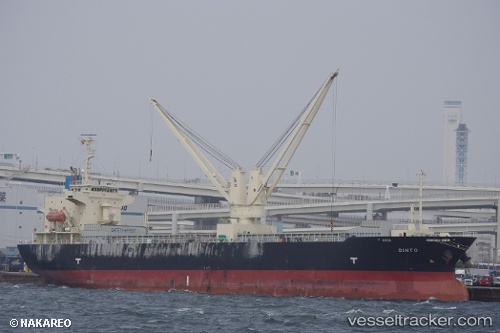
 Ginto
Ginto
Current Status
Where is the vessel?
Ginto is currently in Near Muroran, based on AIS data received less than 1h ago.
Latest AIS update:
Current position: 42.35500° N, 140.97166° E (Near Muroran)
Average speed (last 7 days): Loading…
Average speed (last 30 days): Loading…
Vessel profile: Ginto is a General Cargo Ship with dimensions 120m x 22m.
This page combines live AIS, route history, probable destination signals, nearby traffic, and port activity for practical vessel monitoring.
The current position of vessel Ginto is 42.35500 lat / 140.97166 lng. Updated: 2026-04-29 10:01:43 UTCNearest reference points:
- Near Muroran
- 23 nm NE of SAI
- 11 nm NW of Yokohama, Aomori
Currently sailing under the flag of Philippines ![]()
Ginto built in 2011 year
Deadweight:
12963 tDetails:
Live Vessel Ginto Analytics (details, animations, etc.)
Recent AIS points (UTC):
2026-04-29 07:31:48 UTC · 42.35500, 140.97166 · SOG 0 kn · COG -1°2026-04-29 07:31:48 UTC · 42.35500, 140.97166 · SOG 0 kn · COG -1°
2026-04-29 09:43:43 UTC · 42.35500, 140.97166 · SOG 0 kn · COG -1°
2026-04-29 10:01:43 UTC · 42.35500, 140.97166 · SOG 0 kn · COG -1°