 vesseltracker.com
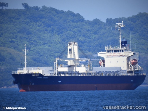
White Tomony
Current StatusWhere is the vessel?
White Tomony is currently in Near Kokura, based on AIS data received about 1h ago.
Latest AIS update:
Current position: 33.89492° N, 130.88278° E (Near Kokura)
Average speed (last 7 days): Loading…
Average speed (last 30 days): Loading…
Vessel profile: White Tomony is a General Cargo Ship with dimensions 20m x 128m.
This page combines live AIS, route history, probable destination signals, nearby traffic, and port activity for practical vessel monitoring.
The current position of vessel White Tomony is 33.89492 lat / 130.88278 lng. Updated: 2026-04-26 17:51:12 UTCNearest reference points:
- Near Kanmon
- Near Kokura
- Near Shimonoseki
Details:
Live Vessel White Tomony Analytics (details, animations, etc.)
Recent AIS points (UTC):
2026-04-26 13:57:12 UTC · 33.89507, 130.88274 · SOG 0.1 kn · COG 226°2026-04-26 15:57:12 UTC · 33.89493, 130.88277 · SOG 0 kn · COG 226°
2026-04-26 16:24:12 UTC · 33.89495, 130.88280 · SOG 0.1 kn · COG 226°
2026-04-26 17:51:12 UTC · 33.89492, 130.88278 · SOG 0.1 kn · COG 226°