 vesseltracker.com
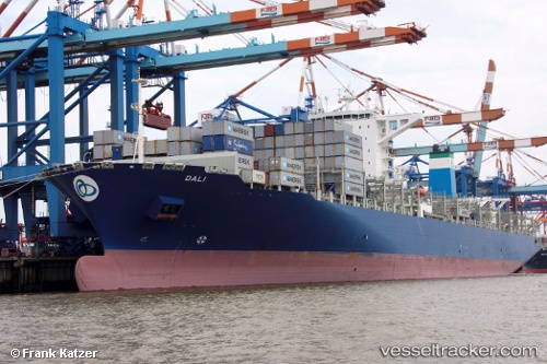
 Dali
Dali
Current Status
Where is the vessel?
Dali is currently in Near Port Louis, based on AIS data received less than 1h ago.
Latest AIS update:
Current position: 20.14129° S, 57.49133° E (Near Port Louis)
Average speed (last 7 days): Loading…
Average speed (last 30 days): Loading…
Vessel profile: Dali is a Container Ship with dimensions 300m x 300m.
This page combines live AIS, route history, probable destination signals, nearby traffic, and port activity for practical vessel monitoring.
The current position of vessel Dali is -20.14129 lat / 57.49133 lng. Updated: 2026-05-16 00:09:59 UTCNearest reference points:
- Near Port Louis
- 164 nm NW of Pointe aux Canonniers
Currently sailing under the flag of Singapore ![]()
Details:
Live Vessel Dali Analytics (details, animations, etc.)
Recent AIS points (UTC):
2026-05-15 20:12:59 UTC · -20.14134, 57.49132 · SOG 0 kn · COG 238°2026-05-15 21:54:59 UTC · -20.14130, 57.49130 · SOG 0 kn · COG 238°
2026-05-15 22:01:03 UTC · -20.14128, 57.49129 · SOG 0 kn · COG 238°
2026-05-16 00:09:59 UTC · -20.14129, 57.49133 · SOG 0 kn · COG 238°