 vesseltracker.com
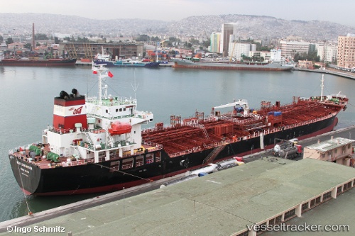
 MTM SINGAPORE
Current Status
Where is the vessel?
MTM SINGAPORE is currently in 34 nm S of Sarinena, based on AIS data received less than 1h ago.
Latest AIS update:
Current position: 41.22286° N, 9.94044° W (34 nm S of Sarinena)
Average speed (last 7 days): Loading…
Average speed (last 30 days): Loading…
Vessel profile: MTM SINGAPORE is a Chemical Tanker with dimensions 24m x 145m.
This page combines live AIS, route history, probable destination signals, nearby traffic, and port activity for practical vessel monitoring.
The current position of vessel MTM SINGAPORE is 41.22286 lat / -9.94044 lng. Updated: 2026-04-10 04:22:06 UTCNearest reference points:
- 11 nm S of Sarinena
- 52 nm W of Canas de Santa Maria
- Near POVOA DE VARZIM
Currently sailing under the flag of Singapore ![]()
MTM SINGAPORE built in 2011 year
Deadweight:
19996 tDetails:
Live Vessel MTM SINGAPORE Analytics (details, animations, etc.)
Recent AIS points (UTC):
2026-04-09 21:27:05 UTC · 39.99274, -9.94950 · SOG 11.8 kn · COG 2°2026-04-10 00:31:27 UTC · 40.55551, -9.95362 · SOG 9.9 kn · COG 359°
2026-04-10 02:37:45 UTC · 40.92006, -9.94727 · SOG 10.3 kn · COG 358°
2026-04-10 04:22:06 UTC · 41.22286, -9.94044 · SOG 10.6 kn · COG 356°