 vesseltracker.com
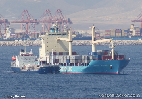
 CAPITAINE TUPAIA
Current Status
Where is the vessel?
CAPITAINE TUPAIA is currently in Near Auckland, based on AIS data received about 1h ago.
Latest AIS update:
Current position: 36.84183° S, 174.78346° E (Near Auckland)
Average speed (last 7 days): Loading…
Average speed (last 30 days): Loading…
Vessel profile: CAPITAINE TUPAIA is a Container Ship with dimensions 28m x 175m.
This page combines live AIS, route history, probable destination signals, nearby traffic, and port activity for practical vessel monitoring.
The current position of vessel CAPITAINE TUPAIA is -36.84183 lat / 174.78346 lng. Updated: 2026-04-24 00:08:15 UTCNearest reference points:
- Near WESTHAVEN
- Near ORAKEI
- Near Matiatia Bay
Currently sailing under the flag of Singapore ![]()
CAPITAINE TUPAIA built in 2010 year
Deadweight:
22314 tDetails:
Live Vessel CAPITAINE TUPAIA Analytics (details, animations, etc.)
Recent AIS points (UTC):
2026-04-23 19:45:47 UTC · -36.84167, 174.78333 · SOG 0 kn · COG -1°2026-04-23 21:59:11 UTC · -36.84162, 174.78333 · SOG 0 kn · COG 348°
2026-04-23 22:56:13 UTC · -36.84217, 174.78349 · SOG 0 kn · COG 347°
2026-04-24 00:08:15 UTC · -36.84183, 174.78346 · SOG 0 kn · COG 347°