 vesseltracker.com
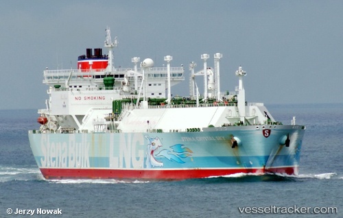
 BW ENN CRYSTAL SKY
Current Status
Where is the vessel?
BW ENN CRYSTAL SKY is currently in Near PASIR GUDANG, based on AIS data received less than 1h ago.
Latest AIS update:
Current position: 1.45440° N, 103.87665° E (Near PASIR GUDANG)
Average speed (last 7 days): Loading…
Average speed (last 30 days): Loading…
Vessel profile: BW ENN CRYSTAL SKY is a Lng Tanker with dimensions m x m.
This page combines live AIS, route history, probable destination signals, nearby traffic, and port activity for practical vessel monitoring.
The current position of vessel BW ENN CRYSTAL SKY is 1.45440 lat / 103.87665 lng. Updated: 2026-04-28 11:53:50 UTCNearest reference points:
- Near PASIR GUDANG
- Near Johor
- Near SEMBAWANG
Currently sailing under the flag of Singapore ![]()
Details:
Live Vessel BW ENN CRYSTAL SKY Analytics (details, animations, etc.)
Recent AIS points (UTC):
2026-04-28 08:28:47 UTC · 1.45432, 103.87680 · SOG 0 kn · COG 55°2026-04-28 10:01:47 UTC · 1.45432, 103.87679 · SOG 0 kn · COG 55°
2026-04-28 10:50:52 UTC · 1.45433, 103.87678 · SOG 0 kn · COG 55°
2026-04-28 11:53:50 UTC · 1.45440, 103.87665 · SOG 0 kn · COG -1°