 vesseltracker.com
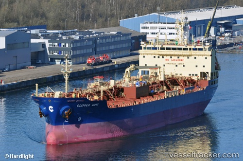
 MARI GALAXY
Current Status
Where is the vessel?
MARI GALAXY is currently in 40 nm SE of Lockeport, based on AIS data received less than 1h ago.
Latest AIS update:
Current position: 43.22355° N, 64.47681° W (40 nm SE of Lockeport)
Average speed (last 7 days): Loading…
Average speed (last 30 days): Loading…
Vessel profile: MARI GALAXY is a Oil/Chemical Tanker with dimensions m x m.
This page combines live AIS, route history, probable destination signals, nearby traffic, and port activity for practical vessel monitoring.
The current position of vessel MARI GALAXY is 43.22355 lat / -64.47681 lng. Updated: 2026-04-26 18:08:57 UTCNearest reference points:
- Near Liverpool
- Near Lower Woods Harbour
- Near Wedgeport
Currently sailing under the flag of Singapore ![]()
Details:
Live Vessel MARI GALAXY Analytics (details, animations, etc.)
Recent AIS points (UTC):
2026-04-26 13:24:58 UTC · 42.86488, -65.79148 · SOG 14.1 kn · COG 90°2026-04-26 15:37:49 UTC · 42.97574, -65.14357 · SOG 13.4 kn · COG 63°
2026-04-26 16:46:05 UTC · 43.08697, -64.83985 · SOG 13.2 kn · COG 63°
2026-04-26 18:08:57 UTC · 43.22355, -64.47681 · SOG 13 kn · COG 63°