 vesseltracker.com
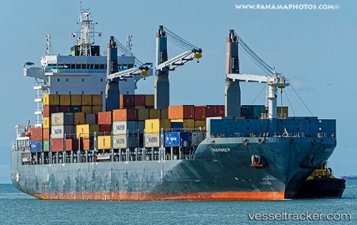
 Mariner
Current Status
Where is the vessel?
Mariner is currently in 72 nm NE of Piñas, based on AIS data received about 1h ago.
Latest AIS update:
Current position: 4.71654° N, 79.07897° W (72 nm NE of Piñas)
Average speed (last 7 days): Loading…
Average speed (last 30 days): Loading…
Vessel profile: Mariner is a Container Ship with dimensions 189m x 30m.
This page combines live AIS, route history, probable destination signals, nearby traffic, and port activity for practical vessel monitoring.
The current position of vessel Mariner is 4.71654 lat / -79.07897 lng. Updated: 2026-04-24 01:31:47 UTCNearest reference points:
- 33 nm W of Buenaventura
- Near Buenaventura
- 20 nm S of El Puerto
Currently sailing under the flag of Singapore ![]()
Details:
Live Vessel Mariner Analytics (details, animations, etc.)
Recent AIS points (UTC):
2026-04-23 22:31:51 UTC · 5.13197, -79.32195 · SOG 9.9 kn · COG 152°2026-04-23 23:40:11 UTC · 4.97336, -79.22568 · SOG 9.9 kn · COG 150°
2026-04-24 01:04:17 UTC · 4.77888, -79.10873 · SOG 9.4 kn · COG 152°
2026-04-24 01:31:47 UTC · 4.71654, -79.07897 · SOG 8.9 kn · COG 182°