 vesseltracker.com
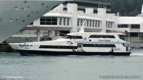
Sindo 12
Current StatusWhere is the vessel?
Sindo 12 is currently in Near Pasir Panjang Wharves, based on AIS data received about 1h ago.
Latest AIS update:
Current position: 1.26893° N, 103.79536° E (Near Pasir Panjang Wharves)
Average speed (last 7 days): Loading…
Average speed (last 30 days): Loading…
Vessel profile: Sindo 12 is a Passenger Ship with dimensions 6m x 32m.
This page combines live AIS, route history, probable destination signals, nearby traffic, and port activity for practical vessel monitoring.
The current position of vessel Sindo 12 is 1.26893 lat / 103.79536 lng. Updated: 2026-05-14 15:38:20 UTCNearest reference points:
- Near Bukit Merah Estate
- Near Pasir Panjang Wharves
- Near Singapore
Details:
Live Vessel Sindo 12 Analytics (details, animations, etc.)
Recent AIS points (UTC):
2026-05-14 12:21:08 UTC · 1.22535, 103.77880 · SOG 0.4 kn · COG -1°2026-05-14 13:29:15 UTC · 1.26905, 103.79521 · SOG 0.1 kn · COG -1°
2026-05-14 14:25:36 UTC · 1.26895, 103.79537 · SOG 0.2 kn · COG -1°
2026-05-14 15:38:20 UTC · 1.26893, 103.79536 · SOG 0 kn · COG -1°