 vesseltracker.com
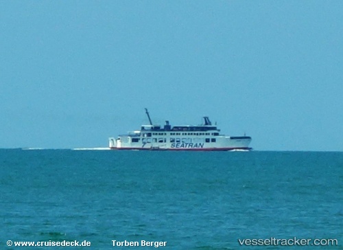
Seatran Ferry 7
Current StatusWhere is the vessel?
Seatran Ferry 7 is currently in Near Unithai Container Terminal, based on AIS data received less than 1h ago.
Latest AIS update:
Current position: 13.57070° N, 100.57479° E (Near Unithai Container Terminal)
Average speed (last 7 days): Loading…
Average speed (last 30 days): Loading…
Vessel profile: Seatran Ferry 7 is a Passenger Ro Ro Cargo Ship with dimensions 14m x 63m.
This page combines live AIS, route history, probable destination signals, nearby traffic, and port activity for practical vessel monitoring.
The current position of vessel Seatran Ferry 7 is 13.57070 lat / 100.57479 lng. Updated: 2026-05-16 07:41:33 UTCNearest reference points:
- Near Unithai Container Terminal
- Near Samut Prakan
- Near Nim Port
Details:
Live Vessel Seatran Ferry 7 Analytics (details, animations, etc.)
Recent AIS points (UTC):
2026-05-16 03:08:36 UTC · 13.57070, 100.57479 · SOG 0 kn · COG -1°2026-05-16 03:08:36 UTC · 13.57070, 100.57479 · SOG 0 kn · COG -1°
2026-05-16 07:41:33 UTC · 13.57070, 100.57479 · SOG 0 kn · COG -1°
2026-05-16 07:41:33 UTC · 13.57070, 100.57479 · SOG 0 kn · COG -1°