 vesseltracker.com
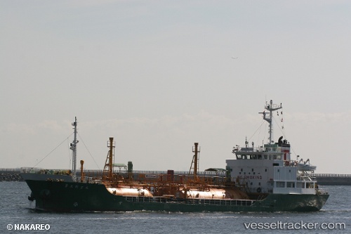
 Pilatus 46
Current Status
Where is the vessel?
Pilatus 46 is currently in Near Si Racha, based on AIS data received less than 1h ago.
Latest AIS update:
Current position: 13.18411° N, 100.90283° E (Near Si Racha)
Average speed (last 7 days): Loading…
Average speed (last 30 days): Loading…
Vessel profile: Pilatus 46 is a Lpg Tanker with dimensions 60m x 11m.
This page combines live AIS, route history, probable destination signals, nearby traffic, and port activity for practical vessel monitoring.
The current position of vessel Pilatus 46 is 13.18411 lat / 100.90283 lng. Updated: 2026-05-14 16:56:26 UTCNearest reference points:
- Near SIRACHA
- Near Sriracha
- Near Tips Container Terminal
Currently sailing under the flag of Thailand ![]()
Details:
Live Vessel Pilatus 46 Analytics (details, animations, etc.)
Recent AIS points (UTC):
2026-05-14 13:26:22 UTC · 13.18409, 100.90296 · SOG 0.1 kn · COG 175°2026-05-14 14:20:25 UTC · 13.18413, 100.90307 · SOG 0 kn · COG 180°
2026-05-14 15:32:20 UTC · 13.18411, 100.90295 · SOG 0 kn · COG 170°
2026-05-14 16:56:26 UTC · 13.18411, 100.90283 · SOG 0 kn · COG 158°