 vesseltracker.com
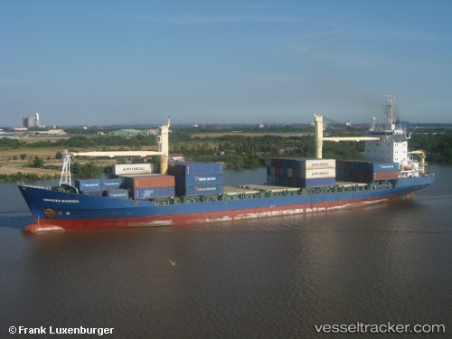
 Biendong Mariner
Current Status
Where is the vessel?
Biendong Mariner is currently in Near Song Than ICD, based on AIS data received less than 1h ago.
Latest AIS update:
Current position: 10.75885° N, 106.73061° E (Near Song Than ICD)
Average speed (last 7 days): Loading…
Average speed (last 30 days): Loading…
Vessel profile: Biendong Mariner is a Container Ship with dimensions 150m x 22m.
This page combines live AIS, route history, probable destination signals, nearby traffic, and port activity for practical vessel monitoring.
The current position of vessel Biendong Mariner is 10.75885 lat / 106.73061 lng. Updated: 2026-04-30 07:54:40 UTCNearest reference points:
- Near Cat Lai Oil Port
- Near Nha Be
- Near Saigon Petro Oil Terminal
Currently sailing under the flag of Vietnam ![]()
Biendong Mariner built in 2004 year
Deadweight:
12474 tDetails:
Live Vessel Biendong Mariner Analytics (details, animations, etc.)
Recent AIS points (UTC):
2026-04-30 02:04:34 UTC · 10.75886, 106.73062 · SOG 0 kn · COG 256°2026-04-30 04:01:10 UTC · 10.75886, 106.73063 · SOG 0 kn · COG 256°
2026-04-30 04:27:35 UTC · 10.75884, 106.73060 · SOG 0 kn · COG 256°
2026-04-30 07:54:40 UTC · 10.75885, 106.73061 · SOG 0 kn · COG 258°