 vesseltracker.com
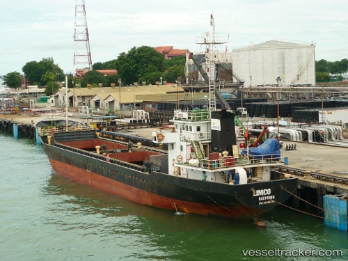
Dai Nghia 18
Current StatusWhere is the vessel?
Dai Nghia 18 is currently in Near Dam Mon, based on AIS data received about 9h ago.
Latest AIS update:
Current position: 12.56167° N, 109.48089° E (Near Dam Mon)
Average speed (last 7 days): Loading…
Average speed (last 30 days): Loading…
Vessel profile: Dai Nghia 18 is a General Cargo Ship with dimensions 11m x 70m.
This page combines live AIS, route history, probable destination signals, nearby traffic, and port activity for practical vessel monitoring.
The current position of vessel Dai Nghia 18 is 12.56167 lat / 109.48089 lng. Updated: 2026-05-14 09:51:41 UTCNearest reference points:
- 29 nm NE of Vung Ro
- Near Vinh Cam Ranh
- Near Bong Son
Details:
Live Vessel Dai Nghia 18 Analytics (details, animations, etc.)
Recent AIS points (UTC):
2026-05-14 09:51:41 UTC · 12.56167, 109.48089 · SOG 5.8 kn · COG -1°2026-05-14 09:51:41 UTC · 12.56167, 109.48089 · SOG 5.8 kn · COG -1°
2026-05-14 09:51:41 UTC · 12.56167, 109.48089 · SOG 5.8 kn · COG -1°
2026-05-14 09:51:41 UTC · 12.56167, 109.48089 · SOG 5.8 kn · COG -1°