 vesseltracker.com
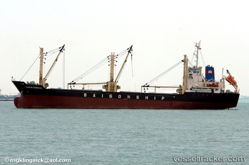
Tan Binh 89
Current StatusWhere is the vessel?
Tan Binh 89 is currently in Near Port Kelang, based on AIS data received less than 1h ago.
Latest AIS update:
Current position: 2.99450° N, 101.39315° E (Near Port Kelang)
Average speed (last 7 days): Loading…
Average speed (last 30 days): Loading…
Vessel profile: Tan Binh 89 is a Bulk Carrier with dimensions 17m x 103m.
This page combines live AIS, route history, probable destination signals, nearby traffic, and port activity for practical vessel monitoring.
The current position of vessel Tan Binh 89 is 2.99450 lat / 101.39315 lng. Updated: 2026-04-30 15:41:37 UTCNearest reference points:
- Near Port Swettenham
- Near PORT KLANG
- Near Port Klang (Ferry Port)
Details:
Live Vessel Tan Binh 89 Analytics (details, animations, etc.)
Recent AIS points (UTC):
2026-04-30 11:29:37 UTC · 2.99443, 101.39313 · SOG 0 kn · COG 168°2026-04-30 13:26:37 UTC · 2.99447, 101.39313 · SOG 0 kn · COG 168°
2026-04-30 13:56:36 UTC · 2.99450, 101.39313 · SOG 0 kn · COG 168°
2026-04-30 15:41:37 UTC · 2.99450, 101.39315 · SOG 0 kn · COG 168°