 vesseltracker.com
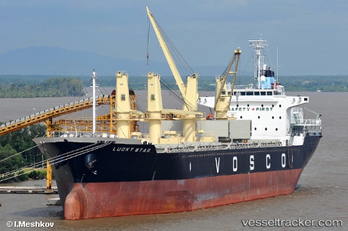
 Lucky Star
Current Status
Where is the vessel?
Lucky Star is currently in 75 nm NE of Pulau Lang Lang, based on AIS data received about 6h ago.
Latest AIS update:
Current position: 8.34920° N, 114.65783° E (75 nm NE of Pulau Lang Lang)
Average speed (last 7 days): Loading…
Average speed (last 30 days): Loading…
Vessel profile: Lucky Star is a Bulk Carrier with dimensions 153m x 26m.
This page combines live AIS, route history, probable destination signals, nearby traffic, and port activity for practical vessel monitoring.
The current position of vessel Lucky Star is 8.34920 lat / 114.65783 lng. Updated: 2026-04-25 15:11:39 UTCNearest reference points:
- 159 nm N of Pulau Lang Lang
- 175 nm N of Pulau Lang Lang
- 44 nm SW of Tembungo
Currently sailing under the flag of Vietnam ![]()
Lucky Star built in 2009 year
Deadweight:
22777 tDetails:
Live Vessel Lucky Star Analytics (details, animations, etc.)
Recent AIS points (UTC):
2026-04-25 15:11:39 UTC · 8.34920, 114.65783 · SOG 10 kn · COG 274°2026-04-25 15:11:39 UTC · 8.34920, 114.65783 · SOG 10 kn · COG 274°
2026-04-25 15:11:39 UTC · 8.34920, 114.65783 · SOG 10 kn · COG 274°
2026-04-25 15:11:39 UTC · 8.34920, 114.65783 · SOG 10 kn · COG 274°