 vesseltracker.com
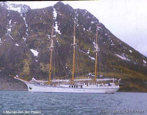
 Rembrandt Van Rijn
Current Status
Where is the vessel?
Rembrandt Van Rijn is currently in 56 nm S of Sveagruva, based on AIS data received about 1h ago.
Latest AIS update:
Current position: 76.94077° N, 15.85456° E (56 nm S of Sveagruva)
Average speed (last 7 days): Loading…
Average speed (last 30 days): Loading…
Vessel profile: Rembrandt Van Rijn is a Cruise Ship with dimensions 49m x 7m.
This page combines live AIS, route history, probable destination signals, nearby traffic, and port activity for practical vessel monitoring.
The current position of vessel Rembrandt Van Rijn is 76.94077 lat / 15.85456 lng. Updated: 2026-04-27 21:05:37 UTCNearest reference points:
- Near Longyearbyen
- 45 nm W of Bjornoya
Currently sailing under the flag of Vanuatu ![]()
Rembrandt Van Rijn built in 1922 year
Deadweight:
350 tDetails:
Live Vessel Rembrandt Van Rijn Analytics (details, animations, etc.)
Recent AIS points (UTC):
2026-04-27 17:21:21 UTC · 77.02581, 15.97960 · SOG 5.3 kn · COG 184°2026-04-27 17:43:29 UTC · 76.98317, 15.91868 · SOG 7.5 kn · COG 202°
2026-04-27 17:43:29 UTC · 76.98317, 15.91868 · SOG 7.5 kn · COG 202°
2026-04-27 21:05:37 UTC · 76.94077, 15.85456 · SOG 0 kn · COG 24°