 vesseltracker.com
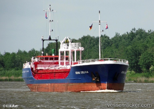
 EVEREST
Current Status
Where is the vessel?
EVEREST is currently in Near Sulina (Port et Zone Franche), based on AIS data received about 3d ago.
Latest AIS update:
Current position: 45.16531° N, 29.87810° E (Near Sulina (Port et Zone Franche))
Average speed (last 7 days): Loading…
Average speed (last 30 days): Loading…
Vessel profile: EVEREST is a General Cargo with dimensions m x m.
This page combines live AIS, route history, probable destination signals, nearby traffic, and port activity for practical vessel monitoring.
The current position of vessel EVEREST is 45.16531 lat / 29.87810 lng. Updated: 2026-05-11 16:44:56 UTCNearest reference points:
- 12 nm SE of Sulina (Port et Zone Franche)
- 13 nm E of Sulina (Port et Zone Franche)
- Near Ust-Dunaisk/Vylkove
Currently sailing under the flag of Vanuatu ![]()
Details:
Live Vessel EVEREST Analytics (details, animations, etc.)
Recent AIS points (UTC):
2026-05-11 16:16:15 UTC · 45.15055, 29.90590 · SOG 3 kn · COG 297°2026-05-11 16:44:56 UTC · 45.16531, 29.87810 · SOG 2.6 kn · COG 284°
2026-05-11 16:44:56 UTC · 45.16531, 29.87810 · SOG 2.6 kn · COG 284°
2026-05-11 16:44:56 UTC · 45.16531, 29.87810 · SOG 2.6 kn · COG 284°