 vesseltracker.com
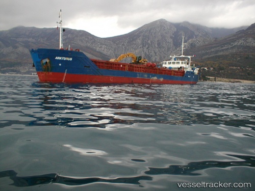
 BOZAT
BOZAT
Current Status
Where is the vessel?
BOZAT is currently in Near Pula, based on AIS data received less than 1h ago.
Latest AIS update:
Current position: 44.79783° N, 14.03465° E (Near Pula)
Average speed (last 7 days): Loading…
Average speed (last 30 days): Loading…
Vessel profile: BOZAT is a General Cargo with dimensions m x m.
This page combines live AIS, route history, probable destination signals, nearby traffic, and port activity for practical vessel monitoring.
The current position of vessel BOZAT is 44.79783 lat / 14.03465 lng. Updated: 2026-04-28 18:20:40 UTCNearest reference points:
- Near Pula
- Near MALI LOSINJ
- Near VALBISKA
Currently sailing under the flag of Vanuatu ![]()
Details:
Live Vessel BOZAT Analytics (details, animations, etc.)
Recent AIS points (UTC):
2026-04-28 13:38:00 UTC · 45.02544, 14.05326 · SOG 0 kn · COG 199°2026-04-28 16:10:40 UTC · 45.02549, 14.05329 · SOG 0 kn · COG 198°
2026-04-28 16:49:49 UTC · 44.97231, 14.07339 · SOG 7 kn · COG 221°
2026-04-28 18:20:40 UTC · 44.79783, 14.03465 · SOG 6.9 kn · COG 196°