 vesseltracker.com
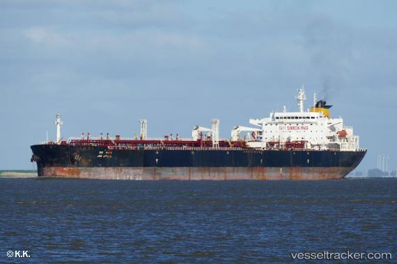
 INA
INA
Current Status
Where is the vessel?
INA is currently in Near Strait Of Gibraltar, based on AIS data received less than 1h ago.
Latest AIS update:
Current position: 35.90957° N, 5.65169° W (Near Strait Of Gibraltar)
Average speed (last 7 days): Loading…
Average speed (last 30 days): Loading…
Vessel profile: INA is a Crude Oil Tanker with dimensions m x m.
This page combines live AIS, route history, probable destination signals, nearby traffic, and port activity for practical vessel monitoring.
The current position of vessel INA is 35.90957 lat / -5.65169 lng. Updated: 2026-05-14 18:09:26 UTCNearest reference points:
- Near TARIFA
- Near TANGER MED
- Near Algeciras
Currently sailing under the flag of Cameroon ![]()
Details:
Live Vessel INA Analytics (details, animations, etc.)
Recent AIS points (UTC):
2026-05-14 14:01:23 UTC · 35.88833, -6.74833 · SOG 12 kn · COG -1°2026-05-14 15:41:56 UTC · 35.89363, -6.31650 · SOG 13.1 kn · COG 88°
2026-05-14 16:34:57 UTC · 35.89539, -6.07727 · SOG 13.3 kn · COG 82°
2026-05-14 18:09:26 UTC · 35.90957, -5.65169 · SOG 13.3 kn · COG 73°