 vesseltracker.com
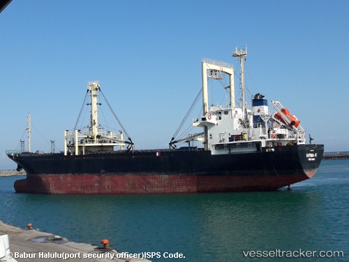
 FATIMA O
Current Status
Where is the vessel?
FATIMA O is currently in Near Port Raysut, based on AIS data received about 1377d ago.
Latest AIS update:
Current position: 16.93991° N, 54.00669° E (Near Port Raysut)
Average speed (last 7 days): Loading…
Average speed (last 30 days): Loading…
Vessel profile: FATIMA O is a General Cargo Ship with dimensions 20m x 97m.
This page combines live AIS, route history, probable destination signals, nearby traffic, and port activity for practical vessel monitoring.
The current position of vessel FATIMA O is 16.93991 lat / 54.00669 lng. Updated: 2022-08-06 05:23:36 UTCNearest reference points:
- 103 nm S of Port Raysut
- 106 nm S of Port Raysut
- 110 nm NE of Gross Koris
Currently sailing under the flag of Comoros ![]()
FATIMA O built in 1994 year
Deadweight:
6833 tDetails:
Live Vessel FATIMA O Analytics (details, animations, etc.)
Recent AIS points (UTC):
2022-08-06 05:23:36 UTC · 16.93991, 54.00669 · SOG 0 kn · COG 0°