 vesseltracker.com
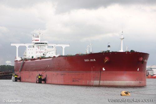
 ANITA
ANITA
Current Status
Where is the vessel?
ANITA is currently in 47 nm NE of PENGERANG, based on AIS data received about 1h ago.
Latest AIS update:
Current position: 1.90586° N, 104.70254° E (47 nm NE of PENGERANG)
Average speed (last 7 days): Loading…
Average speed (last 30 days): Loading…
Vessel profile: ANITA is a Crude Oil Tanker with dimensions m x m.
This page combines live AIS, route history, probable destination signals, nearby traffic, and port activity for practical vessel monitoring.
The current position of vessel ANITA is 1.90586 lat / 104.70254 lng. Updated: 2026-05-14 23:23:18 UTCNearest reference points:
- 45 nm NE of PENGERANG
- 47 nm NE of PENGERANG
- 51 nm NE of PENGERANG
Currently sailing under the flag of Gambia ![]()
Details:
Live Vessel ANITA Analytics (details, animations, etc.)
Recent AIS points (UTC):
2026-05-14 20:13:16 UTC · 1.90510, 104.70114 · SOG 0.3 kn · COG 347°2026-05-14 22:06:16 UTC · 1.90945, 104.70343 · SOG 0.3 kn · COG 256°
2026-05-14 22:18:15 UTC · 1.90868, 104.70376 · SOG 0.2 kn · COG 263°
2026-05-14 23:23:18 UTC · 1.90586, 104.70254 · SOG 0 kn · COG 327°