 vesseltracker.com
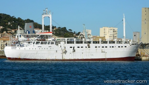
 MAYSA
MAYSA
Current Status
Where is the vessel?
MAYSA is currently in 42 nm SE of OSMAN DIGNA, based on AIS data received about 3h ago.
Latest AIS update:
Current position: 18.78356° N, 38.00757° E (42 nm SE of OSMAN DIGNA)
Average speed (last 7 days): Loading…
Average speed (last 30 days): Loading…
Vessel profile: MAYSA is a Livestock Carrier with dimensions m x m.
This page combines live AIS, route history, probable destination signals, nearby traffic, and port activity for practical vessel monitoring.
The current position of vessel MAYSA is 18.78356 lat / 38.00757 lng. Updated: 2026-05-15 00:47:57 UTCNearest reference points:
- Near Port Sudan
- 53 nm SW of SHUAIBAH
- 99 nm SW of Al Qunfudah
Currently sailing under the flag of Guinea ![]()
Details:
Live Vessel MAYSA Analytics (details, animations, etc.)
Recent AIS points (UTC):
2026-05-14 18:00:49 UTC · 21.47650, 39.16320 · SOG 0.1 kn · COG 343°2026-05-14 18:00:49 UTC · 21.47650, 39.16320 · SOG 0.1 kn · COG 343°
2026-05-14 18:00:49 UTC · 21.47650, 39.16320 · SOG 0.1 kn · COG 343°
2026-05-15 00:47:57 UTC · 18.78356, 38.00757 · SOG 0 kn · COG 343°