 vesseltracker.com
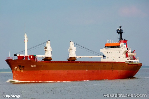
 OLMA
OLMA
Current Status
Where is the vessel?
OLMA is currently in Near Tripoli, based on AIS data received about 1h ago.
Latest AIS update:
Current position: 34.49524° N, 35.81394° E (Near Tripoli)
Average speed (last 7 days): Loading…
Average speed (last 30 days): Loading…
Vessel profile: OLMA is a General Cargo with dimensions m x m.
This page combines live AIS, route history, probable destination signals, nearby traffic, and port activity for practical vessel monitoring.
The current position of vessel OLMA is 34.49524 lat / 35.81394 lng. Updated: 2026-04-25 14:01:45 UTCNearest reference points:
- Near Tripoli
- Near Tartous
- Near Zouk
Currently sailing under the flag of Guinea ![]()
Details:
Live Vessel OLMA Analytics (details, animations, etc.)
Recent AIS points (UTC):
2026-04-25 10:10:41 UTC · 34.53830, 35.53304 · SOG 6.7 kn · COG -1°2026-04-25 12:25:43 UTC · 34.49530, 35.81410 · SOG 0.2 kn · COG -1°
2026-04-25 13:01:44 UTC · 34.49523, 35.81376 · SOG 0.1 kn · COG -1°
2026-04-25 14:01:45 UTC · 34.49524, 35.81394 · SOG 0.1 kn · COG -1°