 vesseltracker.com
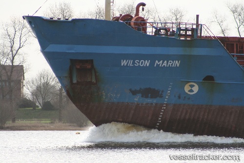
 A.M.K. MARIN
Current Status
Where is the vessel?
A.M.K. MARIN is currently in 42 nm N of UNYE, based on AIS data received about 8d ago.
Latest AIS update:
Current position: 41.81278° N, 37.32417° E (42 nm N of UNYE)
Average speed (last 7 days): Loading…
Average speed (last 30 days): Loading…
Vessel profile: A.M.K. MARIN is a Bulk Carrier with dimensions m x m.
This page combines live AIS, route history, probable destination signals, nearby traffic, and port activity for practical vessel monitoring.
The current position of vessel A.M.K. MARIN is 41.81278 lat / 37.32417 lng. Updated: 2026-04-21 19:09:17 UTCNearest reference points:
- 15 nm W of UNYE
- Near Fatsa
- Near Samsun
Currently sailing under the flag of Guinea ![]()
Details:
Live Vessel A.M.K. MARIN Analytics (details, animations, etc.)
Recent AIS points (UTC):
2026-04-21 19:09:17 UTC · 41.81278, 37.32417 · SOG 9.6 kn · COG -1°2026-04-21 19:09:17 UTC · 41.81278, 37.32417 · SOG 9.6 kn · COG -1°
2026-04-21 19:09:17 UTC · 41.81278, 37.32417 · SOG 9.6 kn · COG -1°
2026-04-21 19:09:17 UTC · 41.81278, 37.32417 · SOG 9.6 kn · COG -1°