 vesseltracker.com
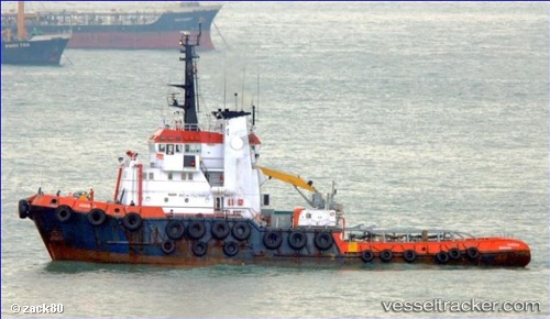
Harrier
Current StatusWhere is the vessel?
Harrier is currently in Open sea (no nearby ports in database), based on AIS data received about 129d ago.
Latest AIS update:
Current position: 85.34356° N, 164.38271° W (Open sea (no nearby ports in database))
Average speed (last 7 days): Loading…
Average speed (last 30 days): Loading…
Vessel profile: Harrier is a [tug.offshore_tug_supply] with dimensions 12m x 44m.
This page combines live AIS, route history, probable destination signals, nearby traffic, and port activity for practical vessel monitoring.
The current position of vessel Harrier is 85.34356 lat / -164.38271 lng. Updated: 2026-01-04 21:12:53 UTCNearest reference points:
- Open sea (no nearby ports in database)
Details:
Live Vessel Harrier Analytics (details, animations, etc.)
Recent AIS points (UTC):
2026-01-04 21:12:53 UTC · 85.34356, -164.38271 · SOG 26.3 kn · COG -1°