 vesseltracker.com
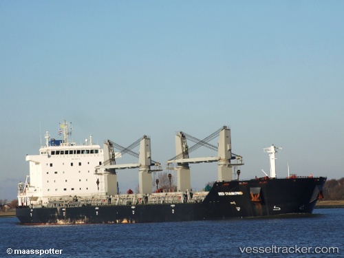
 Red Diamond
Current Status
Where is the vessel?
Red Diamond is currently in 63 nm SE of Kaliorang, based on AIS data received about 16h ago.
Latest AIS update:
Current position: 0.18009° N, 118.70636° E (63 nm SE of Kaliorang)
Average speed (last 7 days): Loading…
Average speed (last 30 days): Loading…
Vessel profile: Red Diamond is a Bulk Carrier with dimensions 190m x 32m.
This page combines live AIS, route history, probable destination signals, nearby traffic, and port activity for practical vessel monitoring.
The current position of vessel Red Diamond is 0.18009 lat / 118.70636 lng. Updated: 2026-04-30 21:03:02 UTCNearest reference points:
- 39 nm W of Labuanbajo
- 56 nm SE of Santan Terminal
- 29 nm W of Labuanbajo
Currently sailing under the flag of Liberia ![]()
Red Diamond built in 2011 year
Deadweight:
53000 tDetails:
Live Vessel Red Diamond Analytics (details, animations, etc.)
Recent AIS points (UTC):
2026-04-30 21:03:02 UTC · 0.18009, 118.70636 · SOG 9.8 kn · COG 34°2026-04-30 21:03:02 UTC · 0.18009, 118.70636 · SOG 9.8 kn · COG 34°
2026-04-30 21:03:02 UTC · 0.18009, 118.70636 · SOG 9.8 kn · COG 34°
2026-04-30 21:03:02 UTC · 0.18009, 118.70636 · SOG 9.8 kn · COG 34°