 vesseltracker.com
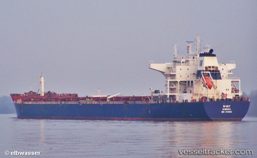
W sky
Current StatusWhere is the vessel?
W sky is currently in 57 nm E of Tami Island, based on AIS data received less than 1h ago.
Latest AIS update:
Current position: 6.72167° S, 148.84833° E (57 nm E of Tami Island)
Average speed (last 7 days): Loading…
Average speed (last 30 days): Loading…
Vessel profile: W sky is a Bulk Carrier with dimensions 38m x 229m.
This page combines live AIS, route history, probable destination signals, nearby traffic, and port activity for practical vessel monitoring.
The current position of vessel W sky is -6.72167 lat / 148.84833 lng. Updated: 2026-04-27 16:03:26 UTCNearest reference points:
- 42 nm E of Tami Island
- Near Lae
Details:
Live Vessel W sky Analytics (details, animations, etc.)
Recent AIS points (UTC):
2026-04-27 12:08:47 UTC · -6.35905, 148.28117 · SOG 10.3 kn · COG 123°2026-04-27 14:12:29 UTC · -6.54500, 148.58501 · SOG 10 kn · COG -1°
2026-04-27 16:03:26 UTC · -6.72167, 148.84833 · SOG 10 kn · COG -1°
2026-04-27 16:03:26 UTC · -6.72167, 148.84833 · SOG 10 kn · COG -1°