 vesseltracker.com
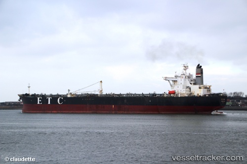
 Etc Mena
Current Status
Where is the vessel?
Etc Mena is currently in 97 nm NE of PANGKAL BALAM, based on AIS data received about 352d ago.
Latest AIS update:
Current position: 0.84363° S, 107.15720° E (97 nm NE of PANGKAL BALAM)
Average speed (last 7 days): Loading…
Average speed (last 30 days): Loading…
Vessel profile: Etc Mena is a Crude Oil Tanker with dimensions 247m x 42m.
This page combines live AIS, route history, probable destination signals, nearby traffic, and port activity for practical vessel monitoring.
The current position of vessel Etc Mena is -0.84363 lat / 107.15720 lng. Updated: 2025-05-07 07:16:44 UTCNearest reference points:
- 46 nm NW of Tanjung Pandan
- 69 nm NE of Exspan
- 74 nm N of Belitung
Currently sailing under the flag of Liberia ![]()
Etc Mena built in 2001 year
Deadweight:
107181 tDetails:
Live Vessel Etc Mena Analytics (details, animations, etc.)
Recent AIS points (UTC):
2025-05-07 07:16:44 UTC · -0.84363, 107.15720 · SOG 8.4 kn · COG 148°