 vesseltracker.com
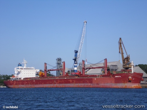
 Anarita
Current Status
Where is the vessel?
Anarita is currently in Near Onne, based on AIS data received less than 1h ago.
Latest AIS update:
Current position: 4.69289° N, 7.15879° E (Near Onne)
Average speed (last 7 days): Loading…
Average speed (last 30 days): Loading…
Vessel profile: Anarita is a Bulk Carrier with dimensions 190m x 33m.
This page combines live AIS, route history, probable destination signals, nearby traffic, and port activity for practical vessel monitoring.
The current position of vessel Anarita is 4.69289 lat / 7.15879 lng. Updated: 2026-04-21 16:23:21 UTCNearest reference points:
- Near Onne
- Near Port Harcourt
- Near Bonny
Currently sailing under the flag of Liberia ![]()
Anarita built in 2012 year
Deadweight:
58018 tDetails:
Live Vessel Anarita Analytics (details, animations, etc.)
Recent AIS points (UTC):
2026-04-21 13:02:20 UTC · 4.69285, 7.15877 · SOG 0 kn · COG 185°2026-04-21 13:47:12 UTC · 4.69287, 7.15874 · SOG 0 kn · COG 185°
2026-04-21 15:32:20 UTC · 4.69279, 7.15863 · SOG 0.1 kn · COG 186°
2026-04-21 16:23:21 UTC · 4.69289, 7.15879 · SOG 0 kn · COG 186°