 vesseltracker.com
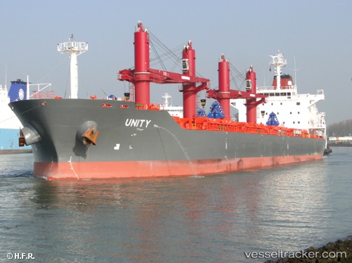
Unity
Current StatusWhere is the vessel?
Unity is currently in Near Bejaia, based on AIS data received about 1h ago.
Latest AIS update:
Current position: 36.72513° N, 5.14485° E (Near Bejaia)
Average speed (last 7 days): Loading…
Average speed (last 30 days): Loading…
Vessel profile: Unity is a Bulk Carrier with dimensions 30m x 180m.
This page combines live AIS, route history, probable destination signals, nearby traffic, and port activity for practical vessel monitoring.
The current position of vessel Unity is 36.72513 lat / 5.14485 lng. Updated: 2026-04-26 04:36:31 UTCNearest reference points:
- Near Bejaia
- Near Carmona
- Near Zamoranos
Details:
Live Vessel Unity Analytics (details, animations, etc.)
Recent AIS points (UTC):
2026-04-26 01:00:31 UTC · 36.72684, 5.14691 · SOG 0 kn · COG 262°2026-04-26 01:06:31 UTC · 36.72680, 5.14687 · SOG 0 kn · COG 264°
2026-04-26 02:24:31 UTC · 36.72514, 5.14548 · SOG 0 kn · COG 352°
2026-04-26 04:36:31 UTC · 36.72513, 5.14485 · SOG 0 kn · COG 7°