 vesseltracker.com
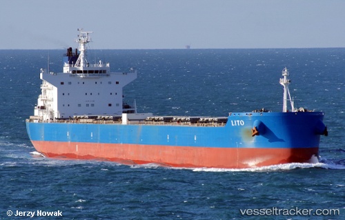
Lito
Current StatusWhere is the vessel?
Lito is currently in Near SKAGEN, based on AIS data received about 1h ago.
Latest AIS update:
Current position: 57.67997° N, 10.64355° E (Near SKAGEN)
Average speed (last 7 days): Loading…
Average speed (last 30 days): Loading…
Vessel profile: Lito is a Bulk Carrier with dimensions 32m x 229m.
This page combines live AIS, route history, probable destination signals, nearby traffic, and port activity for practical vessel monitoring.
The current position of vessel Lito is 57.67997 lat / 10.64355 lng. Updated: 2026-05-17 11:45:15 UTCNearest reference points:
- Near SKAGEN
- Near Frederikshavn
- 19 nm E of Sæby
Details:
Live Vessel Lito Analytics (details, animations, etc.)
Recent AIS points (UTC):
2026-05-17 08:16:25 UTC · 57.48590, 11.39775 · SOG 11.9 kn · COG 304°2026-05-17 10:11:04 UTC · 57.64094, 10.76685 · SOG 7.3 kn · COG 284°
2026-05-17 10:56:34 UTC · 57.67632, 10.64602 · SOG 1.2 kn · COG 269°
2026-05-17 11:45:15 UTC · 57.67997, 10.64355 · SOG 0.1 kn · COG 198°