 vesseltracker.com
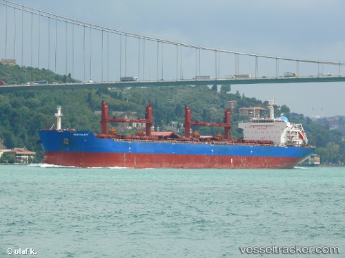
 Oceanlady
Current Status
Where is the vessel?
Oceanlady is currently in 41 nm E of Grobogan, based on AIS data received about 2h ago.
Latest AIS update:
Current position: 7.18266° N, 111.51280° E (41 nm E of Grobogan)
Average speed (last 7 days): Loading…
Average speed (last 30 days): Loading…
Vessel profile: Oceanlady is a Bulk Carrier with dimensions 190m x 32m.
This page combines live AIS, route history, probable destination signals, nearby traffic, and port activity for practical vessel monitoring.
The current position of vessel Oceanlady is 7.18266 lat / 111.51280 lng. Updated: 2026-04-21 07:59:27 UTCNearest reference points:
- 53 nm S of Pulau Lang Lang
- 142 nm N of Pulau Lang Lang
- 141 nm N of Pulau Lang Lang
Currently sailing under the flag of Liberia ![]()
Oceanlady built in 2013 year
Deadweight:
56816 tDetails:
Live Vessel Oceanlady Analytics (details, animations, etc.)
Recent AIS points (UTC):
2026-04-21 04:15:22 UTC · 7.17367, 110.77864 · SOG 12.1 kn · COG -1°2026-04-21 05:20:28 UTC · 7.17668, 110.99434 · SOG 11.8 kn · COG -1°
2026-04-21 06:55:16 UTC · 7.18178, 111.30734 · SOG 11 kn · COG 92°
2026-04-21 07:59:27 UTC · 7.18266, 111.51280 · SOG 11 kn · COG 88°