 vesseltracker.com
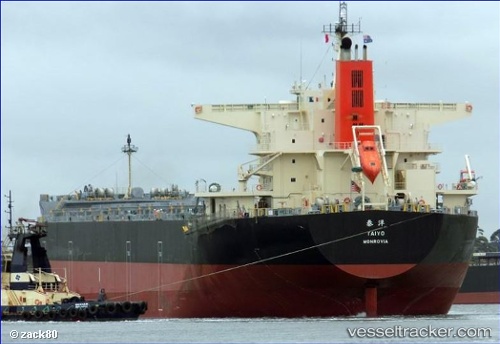
 Taiyo
Taiyo
Current Status
Where is the vessel?
Taiyo is currently in 200 nm SE of Omura, based on AIS data received about 1h ago.
Latest AIS update:
Current position: 25.21859° N, 145.27066° E (200 nm SE of Omura)
Average speed (last 7 days): Loading…
Average speed (last 30 days): Loading…
Vessel profile: Taiyo is a Bulk Carrier with dimensions 235m x 38m.
This page combines live AIS, route history, probable destination signals, nearby traffic, and port activity for practical vessel monitoring.
The current position of vessel Taiyo is 25.21859 lat / 145.27066 lng. Updated: 2026-05-16 14:07:57 UTCCurrently sailing under the flag of Liberia ![]()
Details:
Live Vessel Taiyo Analytics (details, animations, etc.)
Recent AIS points (UTC):
2026-05-16 10:46:49 UTC · 24.64223, 145.42598 · SOG 10.5 kn · COG 340°2026-05-16 11:43:43 UTC · 24.80384, 145.37025 · SOG 10.8 kn · COG 344°
2026-05-16 13:20:44 UTC · 25.08308, 145.29663 · SOG 10.3 kn · COG 346°
2026-05-16 14:07:57 UTC · 25.21859, 145.27066 · SOG 10.5 kn · COG 348°