 vesseltracker.com
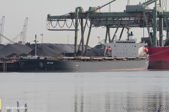
 Cetus
Cetus
Current Status
Where is the vessel?
Cetus is currently in Near Paradip, based on AIS data received less than 1h ago.
Latest AIS update:
Current position: 20.27863° N, 86.66918° E (Near Paradip)
Average speed (last 7 days): Loading…
Average speed (last 30 days): Loading…
Vessel profile: Cetus is a Bulk Carrier with dimensions 225m x 32m.
This page combines live AIS, route history, probable destination signals, nearby traffic, and port activity for practical vessel monitoring.
The current position of vessel Cetus is 20.27863 lat / 86.66918 lng. Updated: 2026-04-27 13:29:47 UTCNearest reference points:
- Near Paradip
- Near Paradip Garh
- 45 nm S of Contai
Currently sailing under the flag of Liberia ![]()
Cetus built in 2003 year
Deadweight:
76845 tDetails:
Live Vessel Cetus Analytics (details, animations, etc.)
Recent AIS points (UTC):
2026-04-27 09:47:47 UTC · 20.27780, 86.66952 · SOG 0.2 kn · COG 26°2026-04-27 09:59:47 UTC · 20.27822, 86.66928 · SOG 0.1 kn · COG 25°
2026-04-27 12:05:47 UTC · 20.27875, 86.66931 · SOG 0.1 kn · COG 25°
2026-04-27 13:29:47 UTC · 20.27863, 86.66918 · SOG 0 kn · COG 25°