 vesseltracker.com
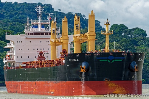
Skyfall
Current StatusWhere is the vessel?
Skyfall is currently in 334 nm SE of Abakaliki, based on AIS data received less than 1h ago.
Latest AIS update:
Current position: 1.53833° N, 88.82167° E (334 nm SE of Abakaliki)
Average speed (last 7 days): Loading…
Average speed (last 30 days): Loading…
Vessel profile: Skyfall is a Bulk Carrier with dimensions 32m x 199m.
This page combines live AIS, route history, probable destination signals, nearby traffic, and port activity for practical vessel monitoring.
The current position of vessel Skyfall is 1.53833 lat / 88.82167 lng. Updated: 2026-05-02 17:29:00 UTCNearest reference points:
- Open sea, approx. 400 nm off the nearest listed port
- Open sea, approx. 401 nm off the nearest listed port
- Open sea, approx. 402 nm off the nearest listed port
Details:
Live Vessel Skyfall Analytics (details, animations, etc.)
Recent AIS points (UTC):
2026-05-02 13:58:54 UTC · 1.96500, 89.39500 · SOG 12 kn · COG -1°2026-05-02 16:01:58 UTC · 1.71333, 89.06167 · SOG 12 kn · COG -1°
2026-05-02 16:52:55 UTC · 1.61167, 88.92333 · SOG 12 kn · COG -1°
2026-05-02 17:29:00 UTC · 1.53833, 88.82167 · SOG 12 kn · COG -1°