 vesseltracker.com
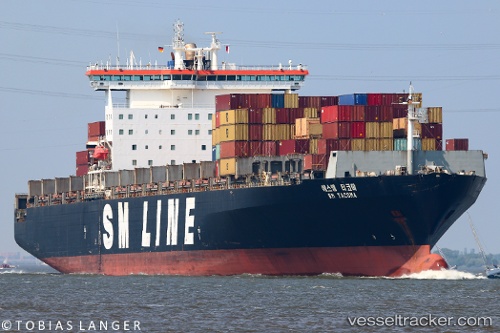
Sm Tacoma
Current StatusWhere is the vessel?
Sm Tacoma is currently in 21 nm E of Bokpoort, based on AIS data received less than 1h ago.
Latest AIS update:
Current position: 32.79411° S, 28.42525° E (21 nm E of Bokpoort)
Average speed (last 7 days): Loading…
Average speed (last 30 days): Loading…
Vessel profile: Sm Tacoma is a Container Ship with dimensions 40m x 278m.
This page combines live AIS, route history, probable destination signals, nearby traffic, and port activity for practical vessel monitoring.
The current position of vessel Sm Tacoma is -32.79411 lat / 28.42525 lng. Updated: 2026-05-14 18:21:44 UTCNearest reference points:
- 23 nm E of Port Saint John's
Details:
Live Vessel Sm Tacoma Analytics (details, animations, etc.)
Recent AIS points (UTC):
2026-05-14 13:55:11 UTC · -31.84202, 29.50746 · SOG 17.3 kn · COG 221°2026-05-14 16:02:05 UTC · -32.29920, 28.99691 · SOG 18.3 kn · COG 223°
2026-05-14 16:07:29 UTC · -32.31909, 28.97475 · SOG 17.9 kn · COG 223°
2026-05-14 18:21:44 UTC · -32.79411, 28.42525 · SOG 17.3 kn · COG 227°