 vesseltracker.com
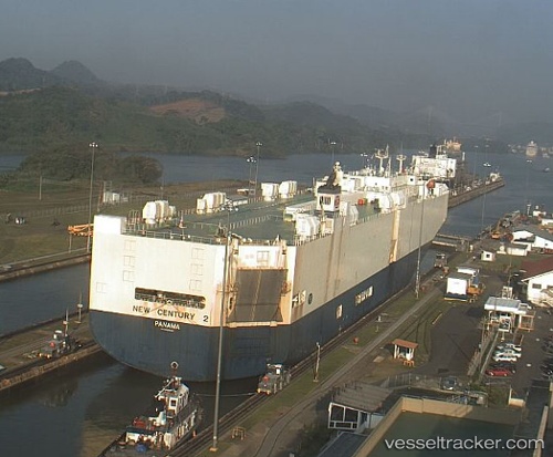
New Century 2
Current StatusWhere is the vessel?
New Century 2 is currently in Open sea (no nearby ports in database), based on AIS data received less than 1h ago.
Latest AIS update:
Current position: 39.77162° N, 179.55679° W (Open sea (no nearby ports in database))
Average speed (last 7 days): Loading…
Average speed (last 30 days): Loading…
Vessel profile: New Century 2 is a Vehicles Carrier with dimensions 32m x 200m.
This page combines live AIS, route history, probable destination signals, nearby traffic, and port activity for practical vessel monitoring.
The current position of vessel New Century 2 is 39.77162 lat / -179.55679 lng. Updated: 2026-05-14 11:55:41 UTCNearest reference points:
- Open sea (no nearby ports in database)
Details:
Live Vessel New Century 2 Analytics (details, animations, etc.)
Recent AIS points (UTC):
2026-05-14 07:35:30 UTC · 39.58207, 178.84850 · SOG 17.2 kn · COG 87°2026-05-14 09:58:46 UTC · 39.68405, 179.72768 · SOG 17.2 kn · COG 85°
2026-05-14 10:20:11 UTC · 39.69909, 179.85866 · SOG 17.2 kn · COG 84°
2026-05-14 11:55:41 UTC · 39.77162, -179.55679 · SOG 17.4 kn · COG 85°